|
|
Post by Ethereal on Feb 2, 2020 21:40:28 GMT -5
Anyone came across these maps from reddit?   I have posted them on City-Data. Not sure if I did so here...What are your thoughts? |
|
|
|
Post by knot on Feb 3, 2020 4:47:33 GMT -5
For the Southern Tablelands and South West Slopes (between where it reads Wagga Wagga and Goulburn on the NSW-only map), I would put Northern CA instead of Southern CA, as their climates match a lot better—ranging from Burrinjuck at the warmest; to Batlow and Wee Jasper at the median; to Kunama and Laurel Hill at the coldest—and this is without counting the Snowy Mountains themselves. Also, "Northern Greece" for Thredbo and surrounds, is downright idiotic.
Otherwise, I'd say it's fairly accurate...for now.
|
|
|
|
Post by jgtheone on Feb 3, 2020 4:55:31 GMT -5
Melbourne confirmed mediterranean paradise.
|
|
|
|
Post by boombo on Feb 15, 2020 9:31:33 GMT -5
How can you make such a clear distinction between all those different desert areas, I thought vast swathes of Australia essentially had no vegetation?
|
|
|
|
Post by knot on Feb 15, 2020 23:44:37 GMT -5
How can you make such a clear distinction between all those different desert areas, I thought vast swathes of Australia essentially had no vegetation? That is a common misconception—that vast swathes of Australia are truly arid. In reality, Australia does not have any truly arid climates; the driest climates receive just under 200 mm, with the grand majority of the Outback straddling 400 mm; rather, a steppe climate. Also, the map is simply fraudulent regarding the region between Albury and Wagga Wagga—here's the real colour of the South West Slopes (Riverina) region:  Much of that region exceeds 1,000 mm with ease, approaching 2,000 mm; yielding grass like emerald. More striking, is why the leeward coastal plain is somehow shown as greener than the windward inland slopes on Ethereal's map—must've been taken during a severe summer drought. The southern inland slopes are, in fact, the wettest region in all of NSW. |
|
|
|
Post by Strewthless on Feb 16, 2020 10:45:43 GMT -5
|
|
|
|
Post by Ethereal on Apr 12, 2020 3:13:17 GMT -5
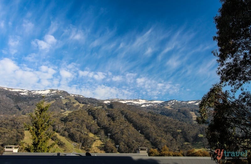
For the Southern Tablelands and South West Slopes (between where it reads Wagga Wagga and Goulburn on the NSW-only map), I would put Northern CA instead of Southern CA, as their climates match a lot better—ranging from Burrinjuck at the warmest; to Batlow and Wee Jasper at the median; to Kunama and Laurel Hill at the coldest—and this is without counting the Snowy Mountains themselves. Also, "Northern Greece" for Thredbo and surrounds, is downright idiotic.Otherwise, I'd say it's fairly accurate...for now. Come to think of it, it's not that far-fetched as both regions have dry-ish rugged landscapes with cool winters? Thredbo:  Northern Greece:  |
|
|
|
Post by knot on Apr 12, 2020 4:58:44 GMT -5
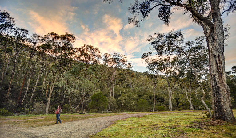
Come to think of it, it's not that far-fetched as both regions have dry-ish rugged landscapes with cool winters? Thredbo: Northern Greece: Still, Northern Greece is just too dry and continental to even remotely match the SW Slopes/Snowy Mountains. Furthermore, Northern Greece's dominant vegetation is deciduous, as opposed to evergreen; thus, Northern California is a significantly better match, and closer in climate as well. The SW Slopes feature a cold rainforest biome—not even close to "dryish":  ^Picture taken between Burrinjuck and Wee Jasper (400–1,000 m). Another two from Jounama/Yarrangobilly, upstream Talbingo (550–1,300 m):   |
|
|
|
Post by Ethereal on Apr 12, 2020 6:01:50 GMT -5
Come to think of it, it's not that far-fetched as both regions have dry-ish rugged landscapes with cool winters? Thredbo: Northern Greece: Still, Northern Greece is just too dry and continental to even remotely match the SW Slopes/Snowy Mountains. Furthermore, Northern Greece's dominant vegetation is deciduous, as opposed to evergreen; thus, Northern California is a significantly better match, and closer in climate as well. The SW Slopes feature a cold rainforest biome—not even close to "dryish":  ^Picture taken between Burrinjuck and Wee Jasper (400–1,000 m). Another two from Jounama/Yarrangobilly, upstream Talbingo (550–1,300 m):   I will concede that the two regions can't be compared as one is deciduous and the other is evergreen. That said, the SW slopes don't look like rainforests to me? They seem like regular sclerophyll dry/wet forests and woodlands. Overall, they look on the dry side of things either way. Are there photos within these forests? Because I found one near Jounama creek and I'd say it's more dry woodland-like (like the Cumberland Plain here in Sydney) than rainforest-y:  Of course, perhaps some pockets may be more rainforest. But I think, overall, they are a dry/wet sclerophyll forest type. |
|
|
|
Post by knot on Apr 12, 2020 17:02:20 GMT -5
I will concede that the two regions can't be compared as one is deciduous and the other is evergreen. That said, the SW slopes don't look like rainforests to me? They seem like regular sclerophyll dry/wet forests and woodlands. Overall, they look on the dry side of things either way. Are there photos within these forests? Because I found one near Jounama creek and I'd say it's more dry woodland-like (like the Cumberland Plain here in Sydney) than rainforest-y: Of course, perhaps some pockets may be more rainforest. But I think, overall, they are a dry/ wet sclerophyll forest type. Wet sclerophyll is what I meant by "cold rainforest"; i.e. during the cooler months. The immediate slopes of the region are extremely wet in winter and/or spring (~ 150–200 mm per month), accompanied by very low evaporation rates due to persistently cool to cold temperatues; the moisture is adequately retained from about May through to October. This is why Batlow and Kunama produce the #No.1 apples in the entire country—nothing beats cool + wet for moisture retainment. However: the region does experience a notable summer dry-season, of which is accentuated by the extremely low humidity, so that's why many pictures appear "dryish" (because travel photography is by far the most common in the summer). Not to mention that the region has often been subject to prolonged summer droughts, and consequently, bushfires. |
|