|
|
Post by Beercules on Oct 18, 2020 1:52:03 GMT -5
|
|
|
|
Post by Morningrise on Oct 18, 2020 10:21:52 GMT -5
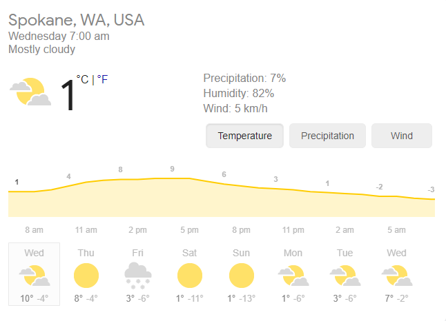
Yesterday's official low was -13.3C, just 1.1C warmer than the daily record low. The forecast has changed a bit and now we only have one day this coming week with a high above freezing. Looks like November came early this year. Geez, we haven't gotten that cold since January 2018. Obviously you're a lot colder than me, but sometimes I'm shocked at how stark the difference is. Yeah, you guys are waaaaay milder than us. Hell even most major cities in Canada are significantly less cold in the winter than Saskatoon. |
|
|
|
Post by ral31 on Oct 18, 2020 12:01:52 GMT -5
This morning's GFS run shows a couple of inches of snow down to Louisiana next week, lol.  |
|
|
|
Post by srfoskey on Oct 18, 2020 16:44:49 GMT -5
This morning's GFS run shows a couple of inches of snow down to Louisiana next week, lol.  Maybe the NW trend will give us some flakes.  |
|
|
|
Post by nei on Oct 18, 2020 18:51:30 GMT -5
still looking good in southern Vermont
|
|
|
|
Post by nei on Oct 18, 2020 21:42:40 GMT -5
higher elevations of Vermont got snow this weekend some more snow photos in the replies
|
|
|
|
Post by Steelernation on Oct 18, 2020 23:09:07 GMT -5
Had an inversion today with thick overcast on the front range and warmer, sunnier conditions in the mountains.
The heavy overcast kept the temps way down so it didn’t get out of the 30s all day and the high was 41 (5 c) at midnight.
0.03” (1 mm) of drizzle fell this morning, snapping the dry streak at 36 days.
|
|
|
|
Post by Ariete on Oct 19, 2020 7:50:49 GMT -5
Surprise snow for big areas of Finland this morning.
Ostrobothnia:
Southern Savonia:
Up to 25 cm in Lapland:
|
|
|
|
Post by jgtheone on Oct 19, 2020 8:35:14 GMT -5
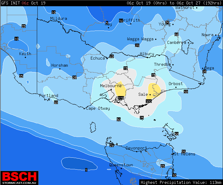
watch us get only 10mm of rain and 10 hours of sun for this period of time  |
|
|
|
Post by rozenn on Oct 19, 2020 16:33:13 GMT -5
First freezes yesterday and this morning in Fontainebleau (70 km SE of Paris). -0.9°C there this morning.
|
|
|
|
Post by jgtheone on Oct 19, 2020 23:20:44 GMT -5
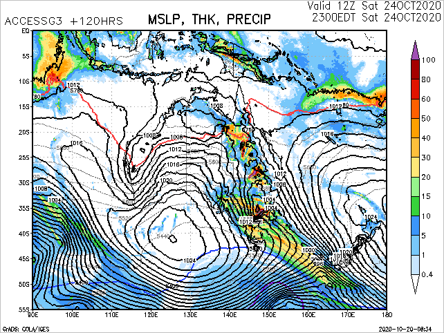
the Melbourne area is being blocked by those pressure symbols so I can't see how much rain we are due for exactly, but surely it's in that 30-40mm range.  |
|
|
|
Post by Beercules on Oct 19, 2020 23:49:54 GMT -5
|
|
|
|
Post by jgtheone on Oct 19, 2020 23:51:30 GMT -5
Yeah. That is exactly why the weather has been so putrid lately with all the southerlies and shit. If only there was a way to manually move it into the tasman and keep it there |
|
|
|
Post by Babu on Oct 20, 2020 2:30:46 GMT -5
Rensjön reached -16.7'C last night. Coldest of the season.
|
|
|
|
Post by Moron on Oct 20, 2020 2:34:48 GMT -5
Rainfall Anomalies for the Year so far Jandakot: 580.2mm Average to oct 31: 769.9mm Perth: 577.0mm Average to oct 31: 696.0mm It doesn't seem like we'll get any more rain for October (at most like 1mm unless we have a spectatularly strong front or storm on the 30th-31st  ) |
|
|
|
Post by aabc123 on Oct 20, 2020 11:39:28 GMT -5
No frosts yet but the coldest day of the season so far. Today's high 5.0c, low 1.1c, dry, partly cloudy. In the evening after 5 pm on the shores of the lake:  A little after 6pm:  |
|
|
|
Post by Doña Jimena on Oct 20, 2020 13:21:45 GMT -5
Chilly with a max of 9C in Riga, but a nice rainbow at least.  |
|
|
|
Post by Ariete on Oct 20, 2020 13:48:16 GMT -5
Chilly with a max of 9C in Riga, but a nice rainbow at least. 
That's your workplace?
|
|
|
|
Post by jgtheone on Oct 21, 2020 9:24:54 GMT -5
Hope they break the record!   |
|
|
|
Post by kronan on Oct 21, 2020 10:08:12 GMT -5
Today's snow map for Sweden.  Most of it will rain away the coming days, but maybe some will remain in northern lapland and in the scandes. |
|