|
|
Post by tommyFL on Jun 2, 2021 12:34:26 GMT -5
24-hour rainfall ending 8 AM this morning. All of us are equal, but some of us are more equal than others. In order words, these kind of showers are absolutely shit for reliable, widespread rain. all pop-up thunderstorms / convection? No, very little thunder with these showers. |
|
|
|
Post by rozenn on Jun 2, 2021 14:07:44 GMT -5
Today's totals in the region (mm). Not a single raindrop here. Radar animations: cdweather.boards.net/post/176475/threadDo you guys notice areas downstream from an UHI getting storms. I'd call this UHI-enhanced rain. Or just bad luck?  Looks like a MCS on the lightning map:  |
|
|
|
Post by Donar on Jun 2, 2021 14:26:03 GMT -5
High was 28 °C with a thunderstorm in the evening, perfect summer day 
|
|
|
|
Post by FrozenI69 on Jun 2, 2021 14:32:59 GMT -5
Current temps don't feel summerlike here, but it is summerlike as you move NNW.  |
|
|
|
Post by Benfxmth on Jun 2, 2021 15:05:16 GMT -5
jetshnl I wind up leaving this in this thread. Ridiculous temps forecast by RDPS for Winnipeg.
|
|
|
|
Post by Strewthless on Jun 2, 2021 15:58:15 GMT -5
Summer's really accelerating now, 4th day in a row the UK has recorded the warmest temperature of the year, 28.3C in London. Although today wasn't as pleasant as previous days, since it was muggier. Storms occurred in multiple places.
|
|
|
|
Post by desiccatedi85 on Jun 2, 2021 17:59:48 GMT -5
High/low of 76/62 here today, average on the dot for June 2 (77/61 is avg). Mostly cloudy skies, very comfortable weather. GFS has a full-on heat wave next week with 5 straight days of 90s, EURO only has 3.
|
|
|
|
Post by tommyFL on Jun 2, 2021 19:32:52 GMT -5
Fort Myers had 4.77" (121.2 mm) of rain today after a May with only 0.04" (1.0 mm). This was the first measurable rain since May 11th and it was a deluge. It easily broke the daily rainfall record for June 2nd of 3.65" (92.7 mm) set in 1922. It was also the wettest day since August 2017 and wettest June day since 1974.
|
|
|
|
Post by ral31 on Jun 2, 2021 21:06:04 GMT -5
I got 4.29" of rain from torrential storms last night. Not really that much lightning during the heaviest of rainfall, but did get a pretty close range strike before (hit about 250 yards away according to radar).
The airport recorded a more modest 1.99".
|
|
|
|
Post by FrozenI69 on Jun 3, 2021 7:31:21 GMT -5
Major heat wanking next week:  |
|
|
|
Post by alex992 on Jun 3, 2021 9:44:25 GMT -5
Fargo, ND's forecast looking more like Fargo, GA.  |
|
|
|
Post by tommyFL on Jun 3, 2021 10:52:19 GMT -5
Starting the wet season with most basins running around 50-60% of normal year-to-date rainfall. My COOP station (Port Salerno 5W) is at 44% of normal as of today.   |
|
|
|
Post by rozenn on Jun 3, 2021 11:09:10 GMT -5
The Paris storm shield ® is as effective as ever. 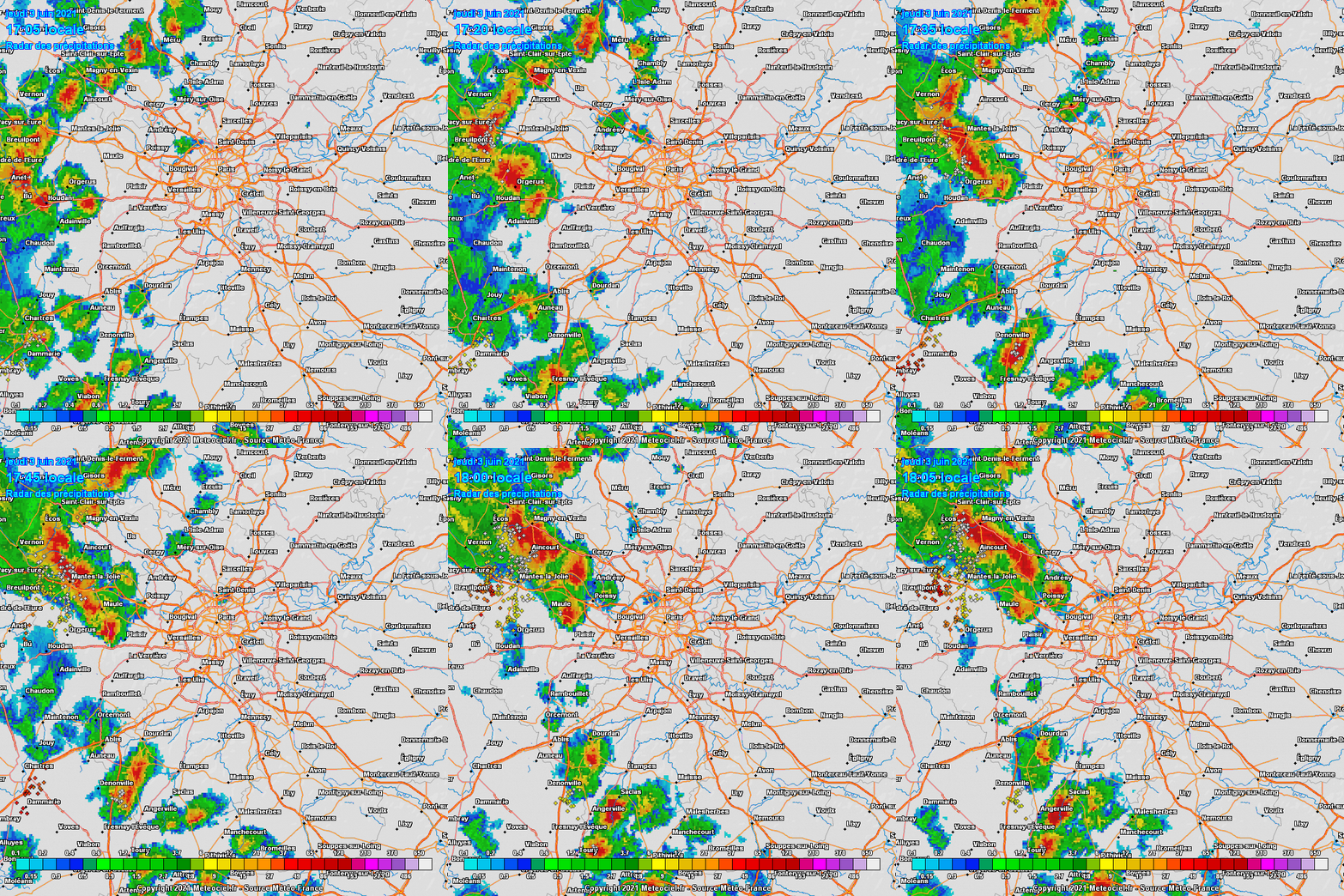 |
|
|
|
Post by Babu on Jun 3, 2021 12:51:18 GMT -5
Warmest day of the year so far today. 24.0'C high recorded at my PWS, and a 10.0'C low. Both the first high above 24'C and the first unofficial low above 10'C. The official airport station only managed a 6.0'C low though. We'll find out soon if the AP managed to break 24.0'C
Edit: The AP got to 24.2'C
|
|
|
|
Post by Babu on Jun 3, 2021 12:55:29 GMT -5
The Paris storm shield ® is as effective as ever.  This phenomenon probably mostly has to do with the areas surrounding Paris being noticably higher elevation.  |
|
|
|
Post by Cadeau on Jun 3, 2021 14:17:34 GMT -5
 According to a 5-minute interval radar map, my neighborhood had 86~120mm/hour of momentary peak rainfall intensity again. Two days in a row. Heard a loud thunderstorm just once followed by a couple of weaker growling that was all. It lasted slightly less than 30 minutes. |
|
|
|
Post by Benfxmth on Jun 3, 2021 14:30:08 GMT -5
Ariete Quite the contrast between a warm western and a cold eastern Europe this week
|
|
|
|
Post by rozenn on Jun 3, 2021 17:03:45 GMT -5
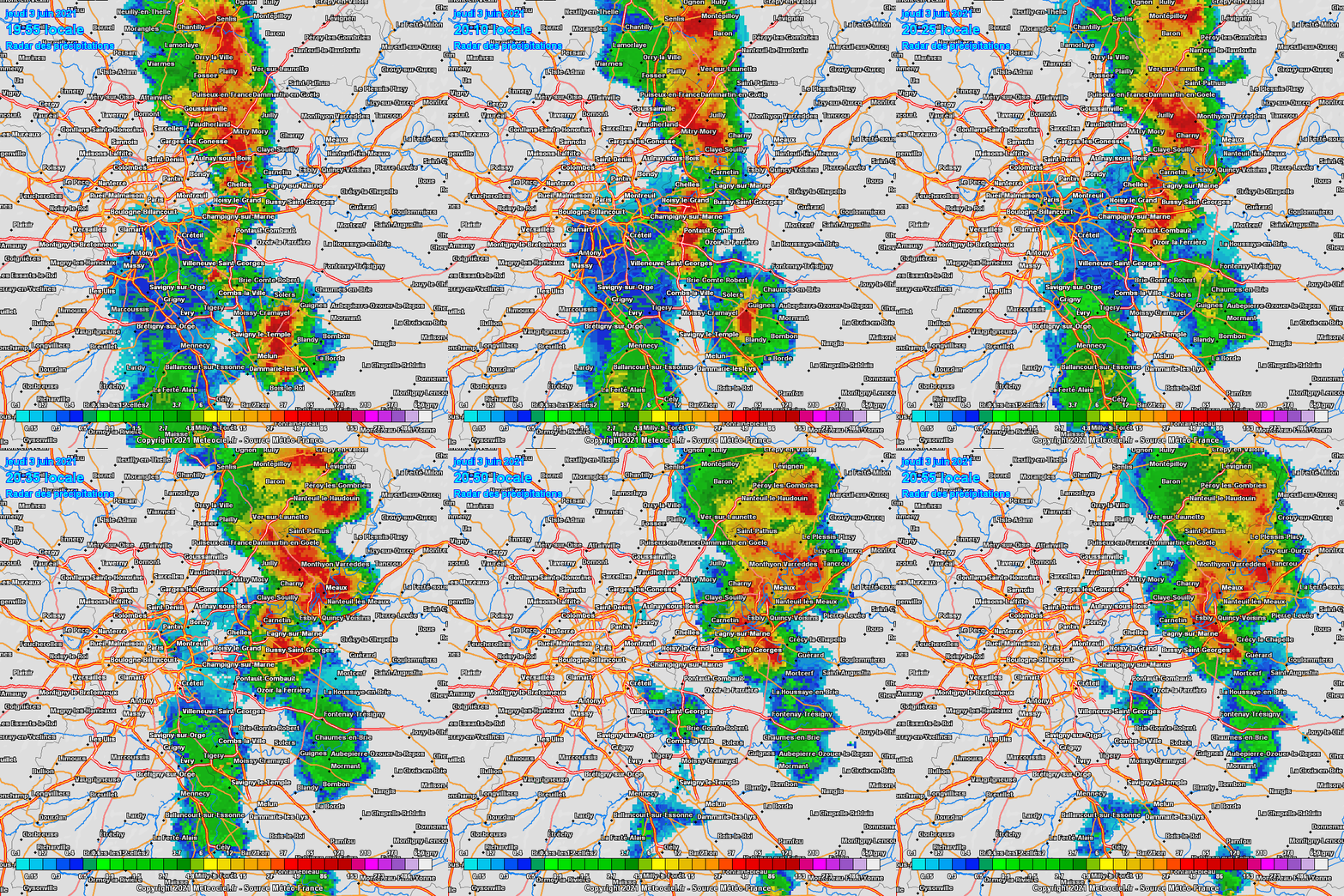
28.5/17.5°C (83/64°F) today at Orly airport, warmest mean of the year so far! Felt rather muggy too with the contrast with the cool late spring. The Paris storm shield ® is as effective as ever. This phenomenon probably mostly has to do with the areas surrounding Paris being noticably higher elevation. I dunno, the differences in elevation are minuscule after all. Look at this, Paris looks like a tstorm factory: 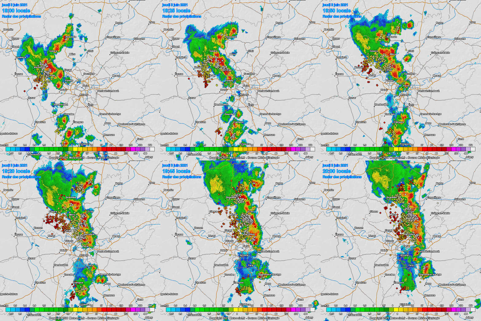 Looks like the exact same places as yesterday got rain again today. I mean, these are the radar totals for yesterday (some flooding reported in the yellow area):  And today: ![]()  Tl;dr: this world is unfair. And look who's on the path of the hole in the storm hole later this night and tomorrow morning. Fuck this.  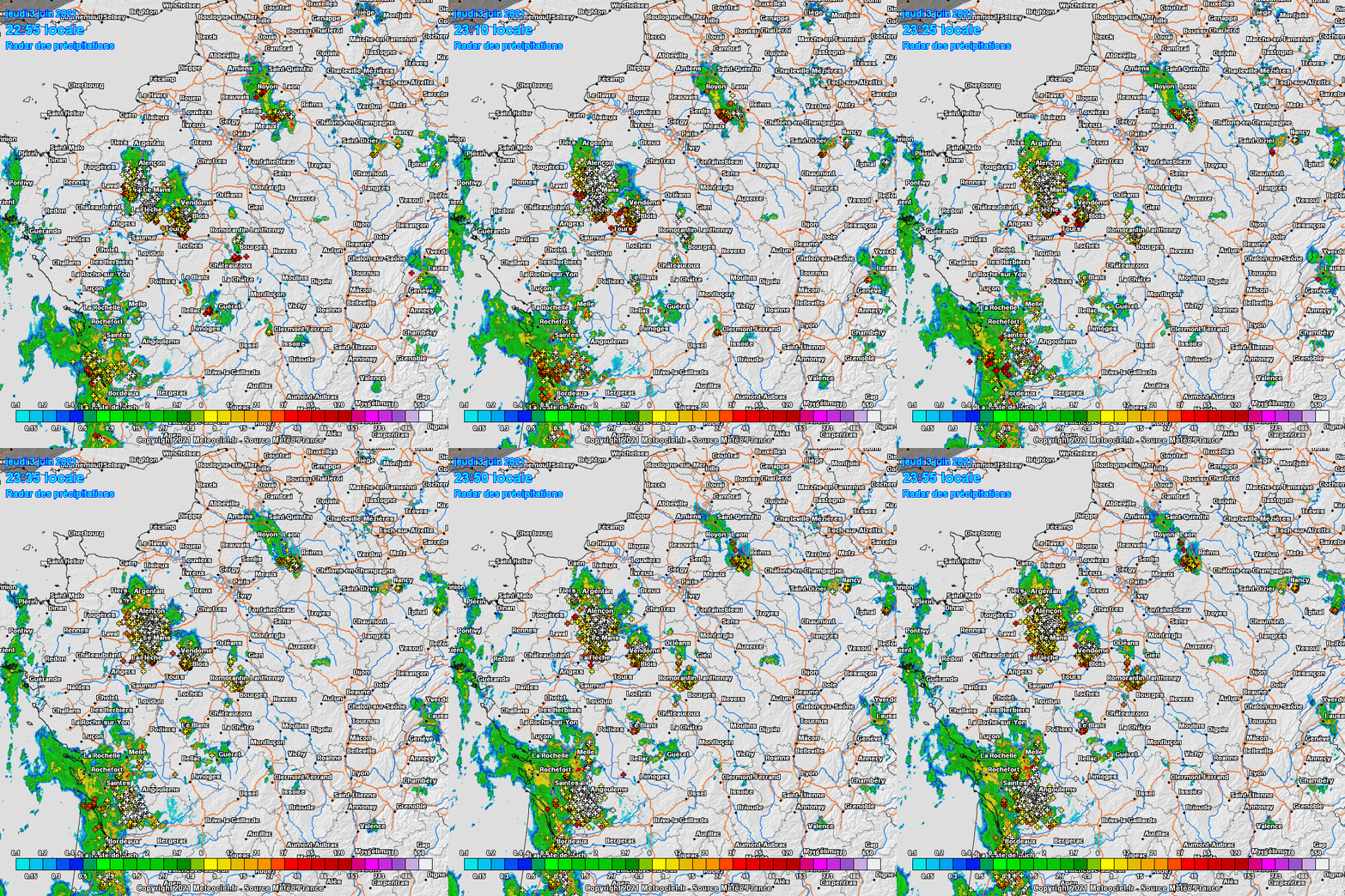 |
|
|
|
Post by rozenn on Jun 3, 2021 17:15:53 GMT -5
Fuck this fuck this fuck this. You go from saturated to crackling ground within a 30 km drive. Frontal storms are much better than this load of crap. Why can't we get them anymore? Btw lmao there's a place called Messy over there. 2-day radar estimations: 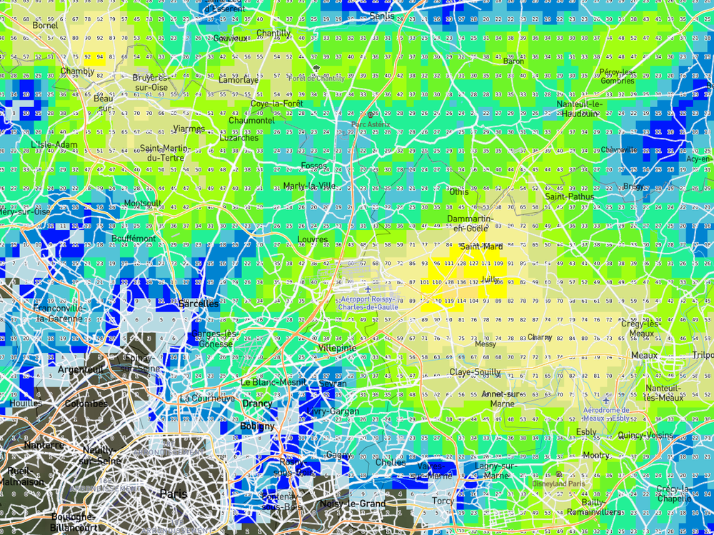 The village of Thieux seems like the rainfall hotspot these days. Yesterday:  Today: 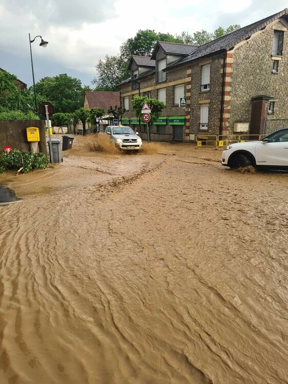 |
|
|
|
Post by rozenn on Jun 3, 2021 22:00:06 GMT -5
At long last!! Just been woken up by thunder. Sorry for spamming lol, I'm obsessed with rain. 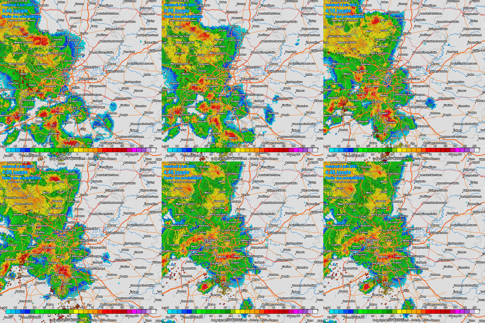 Here's hoping this second line further south doesn't die right in the ass before reaching me. 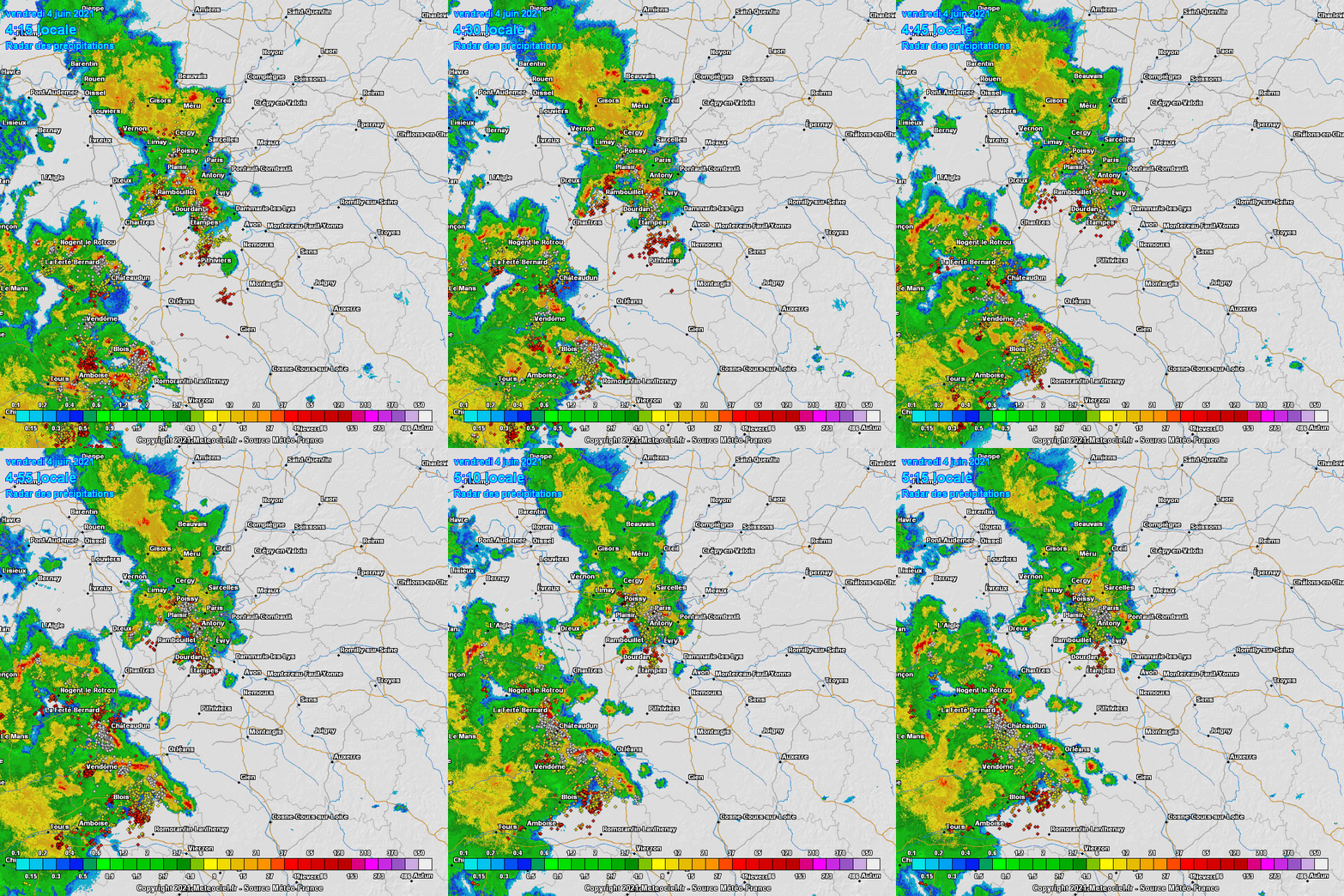 |
|