|
|
Post by Steelernation on Jun 16, 2021 23:11:43 GMT -5
Reached 101.8 (38.8 c) back home today! Impressive heat and that’s tied for the 2nd hottest temp ever.
Unfortunately, Nowdata logged it as 100 (38 c), which is less impressive and noteworthy. Still 100 though so I’m not too mad.
Could’ve been even hotter but we pulled a Shitchester with a 1 PM high and then a big temp drop with clouds into the low 90s for the rest of the afternoon.
|
|
|
|
Post by tommyFL on Jun 16, 2021 23:38:22 GMT -5
Reached 101.8 (38.8 c) back home today! Impressive heat and that’s tied for the 2nd hottest temp ever. Unfortunately, Nowdata logged it as 100 (38 c), which is less impressive and noteworthy. Still 100 though so I’m not too mad. Could’ve been even hotter but we pulled a Shitchester with a 1 PM high and then a big temp drop with clouds into the low 90s for the rest of the afternoon. Why was it recorded as 100? |
|
|
|
Post by Steelernation on Jun 16, 2021 23:41:33 GMT -5
Why was it recorded as 100? No idea. It’s the same thing I’ve complained about before where they often subtract 1-2 f from the actual high to record in Nowdata. Never got around to emailing them about it, someday I should. |
|
|
|
Post by rozenn on Jun 17, 2021 2:52:56 GMT -5
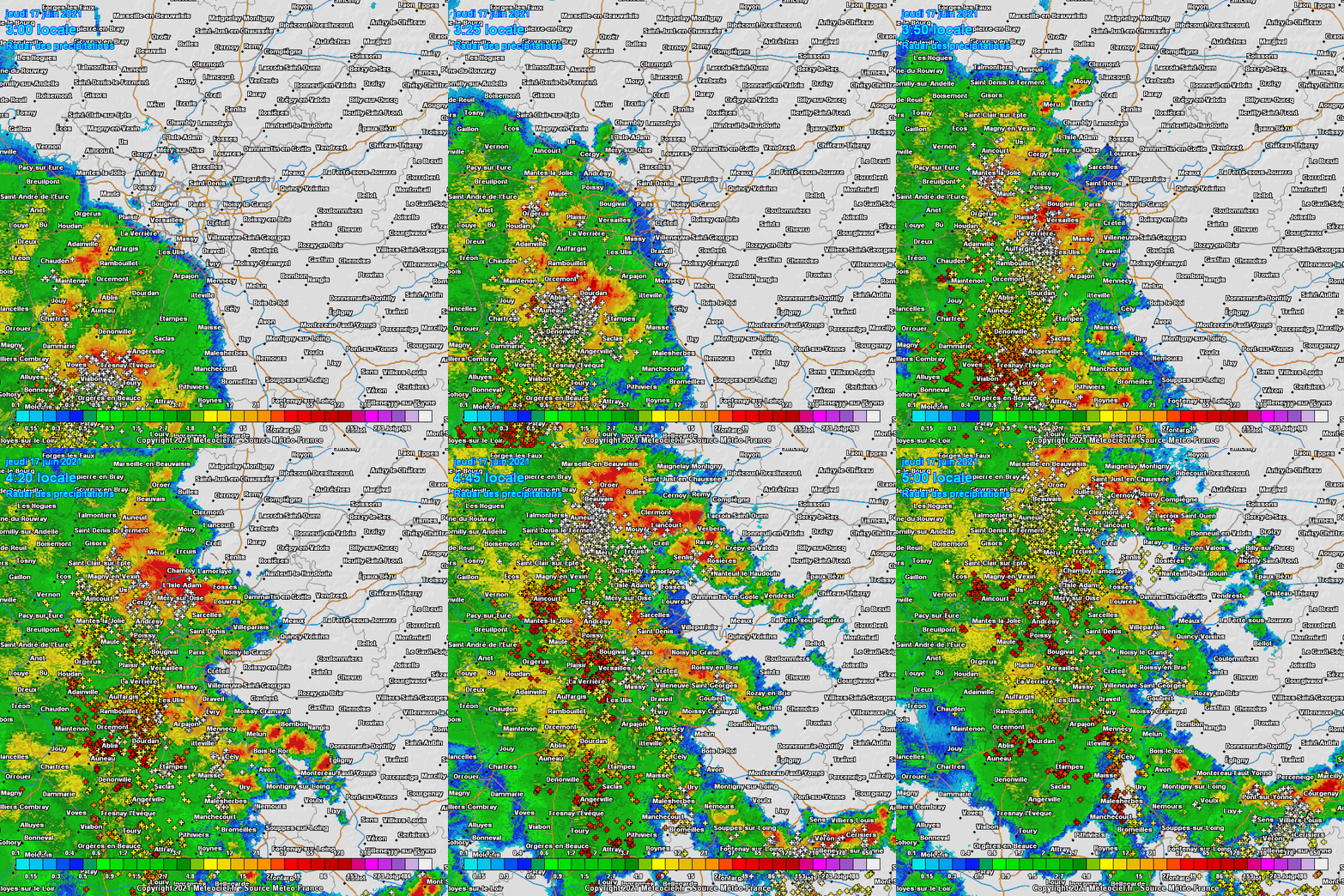
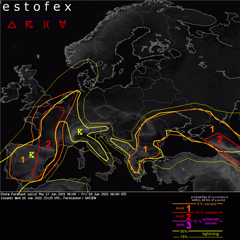
Got woken up by a storm last night, but this time not because of thunder but because of the wind throwing stuff around in my apartment due to the open windows. Montsouris clocked 91 km/h gusts from the first storm. Much calmer during the second one. 107 km/h gust @ the Eiffel tower. Also notice the temp dropping from 26.2°C (79°F) to 19.1°C (66°F) from 3 to 4 am there (but only 76 to 70 at ground level @ Montsouris). It would have been quite the warm night without the storms: www.meteociel.fr/temps-reel/obs_villes.php?code2=75107005Nice dews this morning, just shy of the 20°C mark.  Someone might get severe weather in the general area today. One can only hope.  Nice LI values  |
|
|
|
Post by greysrigging on Jun 17, 2021 3:46:34 GMT -5
A decent shower over on the Gove Peninsular with a Gulf Line coming in from Cape York. The airport at Nhulunbuy picked up 10mm, a decent fall for June. having said that, its not out of the ordinary for the east coast of the Top End to pick up showers right into July. The Western Top End including Darwin, the rain is generally gone by the last week in April. Today has been a warm humid day in Darwin with a 32.1c day and a DP atm of 20.5c, above average for June.    |
|
|
|
Post by Doña Jimena on Jun 17, 2021 4:11:55 GMT -5
Scorching heat in Germany today, it will move eastwards tomorrow  |
|
|
|
Post by greysrigging on Jun 17, 2021 5:14:44 GMT -5
If you're in western Western Australia, grab your winter woollens and get ready for much colder and wetter conditions from this weekend. A strong cold front will approach southwest WA on Saturday afternoon, moving across the south west land division, and Perth, during Sunday. This will bring a band of rain, strong and gusty winds, storms and possible hail. For most people, cold weather will be the largest impact, with maximums 4-8 °C below average across western WA and an icy wind chill. Perth's coldest day will be Monday, with a maximum of just 14 °C. As the cold front tracks east, a low pressure system south of WA will linger for several days along the south coast bringing multiple days of showers, gusty winds, and thunderstorms. Most areas in the south west land division will pick up 10-20mm, with 30-70mm possible in some locations near the coast. Tropical moisture will also be pulled down from the Indian Ocean onto the mainland early next week with unseasonal rainfall. Large sections of the Pilbara and Interior can expect rain and thunderstorms on Monday and Tuesday, possibly with heavy falls including for places like Port Hedland, Newman and Warburton. Totals of 20-50mm are possible with isolated falls of up to 100mm. This rain band may even reach Broome. Know your weather. Know your risk. For the latest forecasts and warnings visit our website ow.ly/mxkr50Fcb7w or BOM Weather app. ( Source: BOM ) |
|
|
|
Post by FrozenI69 on Jun 17, 2021 7:40:05 GMT -5
The low humidity weather will finish after today. The low today was 48 F  , and high yesterday was 75 F. Today it's going up to 85 F, and humidity builds at night, with a low temp of 68 F and dews in the 60's. Ugh  . |
|
|
|
Post by Speagles84 on Jun 17, 2021 9:46:41 GMT -5
Chilly day yesterday, only made it to 72F. Overnight low was 43F which was close to the record of 42F. Today will be warmer, but still below average
|
|
|
|
Post by kronan on Jun 17, 2021 9:57:32 GMT -5
|
|
|
|
Post by alex992 on Jun 17, 2021 10:49:59 GMT -5
Very hot today in the Omaha/Eastern NE region, up to 106 F (41.1 C) in some spots.  |
|
|
|
Post by 🖕🏿Mörön🖕🏿 on Jun 17, 2021 13:00:01 GMT -5
Pretty rainy since the heat wave around June 1st (station is West Van Aut which is closer to me than YVR)  |
|
|
|
Post by 🖕🏿Mörön🖕🏿 on Jun 17, 2021 13:02:28 GMT -5
Scorching heat in Germany today, it will move eastwards tomorrow  Congrats...enjoy!  |
|
|
|
Post by Ariete on Jun 17, 2021 13:16:12 GMT -5
Pretty rainy since the heat wave around June 1st (station is West Van Aut which is closer to me than YVR) 
Vancuckver indeed. Nice few days at the start though.
|
|
|
|
Post by Babu on Jun 17, 2021 15:51:23 GMT -5
Apparently the airport got down to 2.9'C last night, the coldest station south of 65.7°N. I also discovered my PWS went offline for some reason on the evening of the 15th. It's fixed now though, and for the missing days I guess I'll just use the Uni's lows since they tend to match up very well. The Uni station didn't dip below 7.4'C. I also have a (less accurate) smart sensor inside a bush right outside my apartment (shade the whole day) which tends to record cooler lows than my PWS, and that one got down to 7.2'C
|
|
|
|
Post by ilmc90 on Jun 17, 2021 18:09:02 GMT -5
Chilly day yesterday, only made it to 72F. Overnight low was 43F which was close to the record of 42F. Today will be warmer, but still below average Almost twin weather again. This morning dropped down to 42 F/6 C here...pretty impressive for mid-June. |
|
|
|
Post by Babu on Jun 18, 2021 1:37:10 GMT -5
Hottest temp from an official station was 29.5'C in Gothenburg. Sadly no 30'C. A lot of PWS and traffic agency stationd recorded 30'C+ temps. It's likely that places inland of Halmstad experienced 30'C+ temps.
|
|
|
|
Post by Babu on Jun 18, 2021 1:47:51 GMT -5
In other news, Halmstad airport recorded a 20.1'C low last night, the first "tropical night" of the year, possibly in the whole nordics, although I'm sure somewhere in Denmark did as well.
Edit: Gothenburg managed to record a 20.5'C low
|
|
|
|
Post by Donar on Jun 18, 2021 4:44:10 GMT -5
Münster airport recorded 35.5 °C yesterday, the highest temperature in Germany this year so far. The warmest nighttime temperatures were 22.6 in Bad Bergzabern (Palatinate), and 22.5 °C in Bad Harzburg at 486 m in the Harz Mountains.
|
|
|
|
Post by Babu on Jun 18, 2021 4:48:27 GMT -5
5 Swedish automatic stations recorded at least 30'C at 11:00 today. This could be one for the record books, although the all-time Swedish June record of 38'C will obviously stand, probably for a very long time.
|
|