|
|
Post by desiccatedi85 on Oct 2, 2021 23:29:49 GMT -5
High/low of 77/59, warmest day of October so far. Tomorrow has a good shot at 80
|
|
|
|
Post by rozenn on Oct 3, 2021 9:38:39 GMT -5
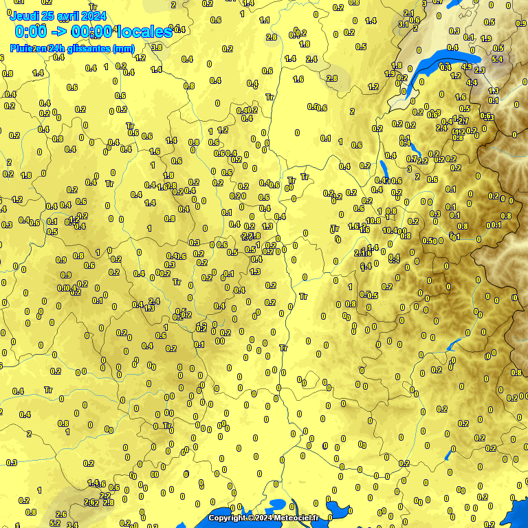
Loads of rain over a large chunk of the country. Tallies from last night:  |
|
|
|
Post by Benfxmth on Oct 3, 2021 13:22:41 GMT -5
|
|
|
|
Post by Benfxmth on Oct 3, 2021 13:42:20 GMT -5
rozenn Southeastern France is getting hammered by heavy rain too, some spots could possibly see 6-8" of rainfall locally the next 36 hours. ECMWF is going bullish on rainfall totals for NW Italy, however. Lol  
|
|
|
|
Post by Benfxmth on Oct 3, 2021 14:11:09 GMT -5
70°F lows in Switzerland in October! Foehn effect ahead of the same frontal system
|
|
|
|
Post by rozenn on Oct 3, 2021 15:29:43 GMT -5
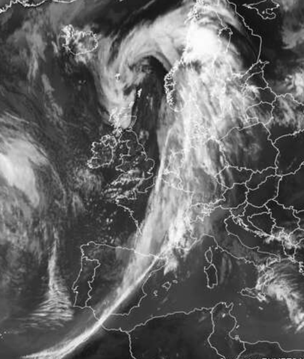
rozenn Southeastern France is getting hammered by heavy rain too, some spots could possibly see 6-8" of rainfall locally the next 36 hours. ECMWF is going bullish on rainfall totals for NW Italy, however. Lol Indeed most of France got substantial rain these past 24 hours. Most was in Villefort, with 452 mm (17.8") from a storm today. Stay safe over there in Italy, this is a bad boy.  Beautiful sat image; the cold front reaches the Sahara:  |
|
|
|
Post by desiccatedi85 on Oct 3, 2021 22:14:22 GMT -5
High/low of 81/63 for a nice summery October day. Could be the last 80s of the year. I already said that once before lol, but warmth returned!
|
|
Deleted
Deleted Member
Posts: 0
|
Post by Deleted on Oct 3, 2021 22:29:53 GMT -5
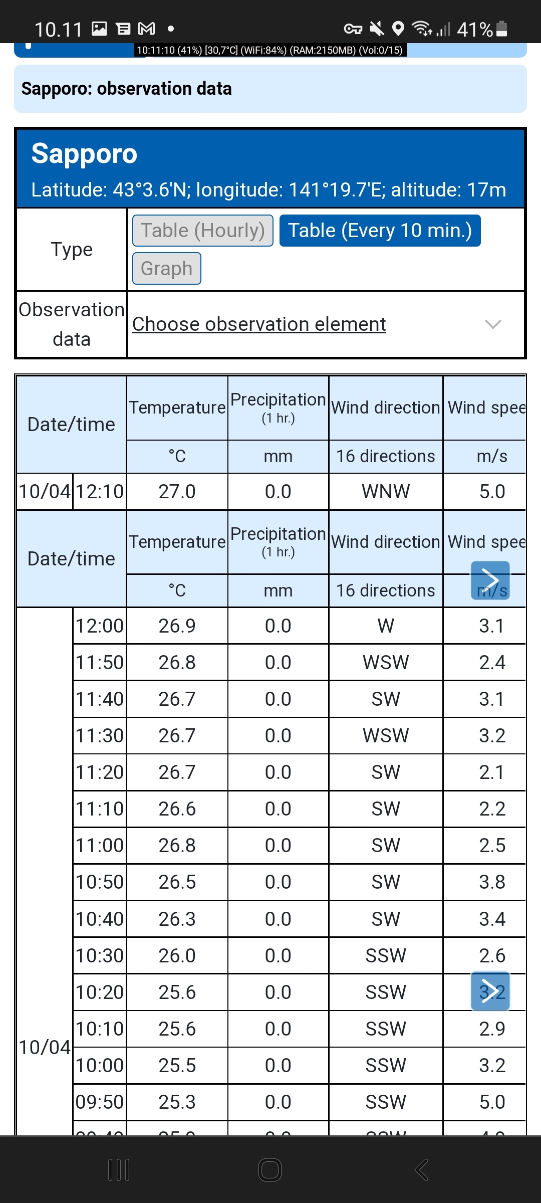
27.0°C/80.6°F in Sapporo as per latest obs (12:10 JST)  Record high for October is 26.4°C/79.5°F according to Wiki (assuming the same station, this breaks the October record) |
|
|
|
Post by Ethereal on Oct 4, 2021 0:10:20 GMT -5
This beautiful temp contrast (snow in the mountains and warm enough to get in the beach on the coast):  |
|
|
|
Post by Benfxmth on Oct 4, 2021 0:47:42 GMT -5
It's this time of year where nocturnal temperature inversions are becoming more common with the shorter days...my PWS only dropped to 64.6°F (18.1°C) last night...whereas Ciampino AP had preliminary 30-minute temp observations going down to 63°F (17°C). rozenn Southeastern France is getting hammered by heavy rain too, some spots could possibly see 6-8" of rainfall locally the next 36 hours. ECMWF is going bullish on rainfall totals for NW Italy, however. Lol Indeed most of France got substantial rain these past 24 hours. Most was in Villefort, with 452 mm (17.8") from a storm today. Stay safe over there in Italy, this is a bad boy. [cut] Beautiful sat image; the cold front reaches the Sahara: [cut] The same, main cold front should arrive here early tomorrow morning—between 03Z and 06Z, though likely with less than impressive rainfall amounts here, with weather models going for between half and three quarters of an inch. Also, those are crazy rainfall tallies in SE France, wonder if records were (or will be) broken |
|
|
|
Post by rozenn on Oct 4, 2021 1:38:26 GMT -5
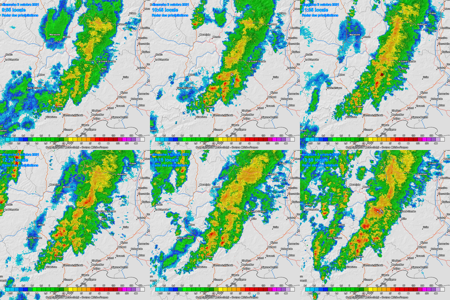
It's this time of year where nocturnal temperature inversions are becoming more common with the shorter days...my PWS only dropped to 64.6°F (18.1°C) last night...whereas Ciampino AP had preliminary 30-minute temp observations going down to 63°F (17°C). Indeed most of France got substantial rain these past 24 hours. Most was in Villefort, with 452 mm (17.8") from a storm today. Stay safe over there in Italy, this is a bad boy. [cut] Beautiful sat image; the cold front reaches the Sahara: [cut] The same, main cold front should arrive here early tomorrow morning—between 03Z and 06Z, though likely with less than impressive rainfall amounts here, with weather models going for between half and three quarters of an inch. Also, those are crazy rainfall tallies in SE France, wonder if records were (or will be) broken Tbh that crazy tally was pretty localized as shown on the map. Apart from that region, the next highest totals were in the Nantes area with around 100 mm. That Cévennes precip was clearly more orographic than frontal, there was a lot of moisture being pushed towards the montains yesterday. Here's a 4-hour radar loop of the area at that time. Most of the rain fell ahead of the front, which you can see approaching towards the end of the animation:  This is a notable event of course, but that area often sees hurricane-like totals thanks to its geography. Last year in September the nearby town of Valleraugue got 718 mm (28.3") of rain in one day. Kinda like parts of the Italian Riviera. |
|
|
|
Post by greysrigging on Oct 4, 2021 2:54:14 GMT -5
|
|
|
|
Post by Beercules on Oct 4, 2021 3:04:16 GMT -5
|
|
|
|
Post by Benfxmth on Oct 4, 2021 3:59:42 GMT -5
An unexpected place for a TC!
|
|
|
|
Post by Beercules on Oct 4, 2021 4:09:21 GMT -5
Well, the waters off Oman are some of the warmest in the world, the 30C+ lows and dewpoints there would give that away, no surprise a hurricane might find its way there.
|
|
|
|
Post by Benfxmth on Oct 4, 2021 4:14:12 GMT -5
Well, the waters off Oman are some of the warmest in the world, the 30C+ lows and dewpoints there would give that away, no surprise a hurricane might find its way there. Well...believe it or not, this is only the second cyclone in modern history to reach Gulf of Oman—since 1890. |
|
|
|
Post by kronan on Oct 4, 2021 9:33:37 GMT -5
 Very high precip totals here in recent days. 113mm. Another 10mm forecasted for the next 24hrs. |
|
|
|
Post by Doña Jimena on Oct 4, 2021 13:18:32 GMT -5
Dry under high pressure. Mostly cloudy and min 9C/max 16C in Riga.
|
|
|
|
Post by Ethereal on Oct 4, 2021 20:35:53 GMT -5
Another striking temp contrast in SE Australia today (though not as impressive as yesterday's):  |
|
|
|
Post by knot on Oct 4, 2021 20:42:24 GMT -5
Currently just 4° C with intermittent drizzle here @ midday.
|
|