|
|
Post by jetshnl on May 19, 2022 17:12:12 GMT -5
|
|
|
|
Post by rozenn on May 19, 2022 17:15:43 GMT -5
First 18°C+ dews of the year this morning. Of course we got fuck all in terms of storms apart from the western suburbs last night.
|
|
|
|
Post by greysrigging on May 19, 2022 17:23:48 GMT -5
Sure is....Seems this is the year of the endless La Nina on the east coast |
|
|
|
Post by Steelernation on May 19, 2022 20:43:24 GMT -5
Epic cold front passed through about 7 PM.
6:40 PM: 83 f (28 c)
6:50 PM: 76 f (24 c)
7:00 PM: 59 f (15 c)
Now it’s down to 53 (12 c) 40 minutes later. Sometime I really want to be outside while one of these sudden fronts comes, would be cool to feel it suddenly get much colder.
NWS now saying 3-4” of snow, Saturday would be the T-5th latest measurable snow.
|
|
|
|
Post by greysrigging on May 20, 2022 0:38:07 GMT -5
Just saw this on City-data.....thats an epic min temp for Brasilia if confirmed true !!  |
|
|
|
Post by rozenn on May 20, 2022 0:42:58 GMT -5
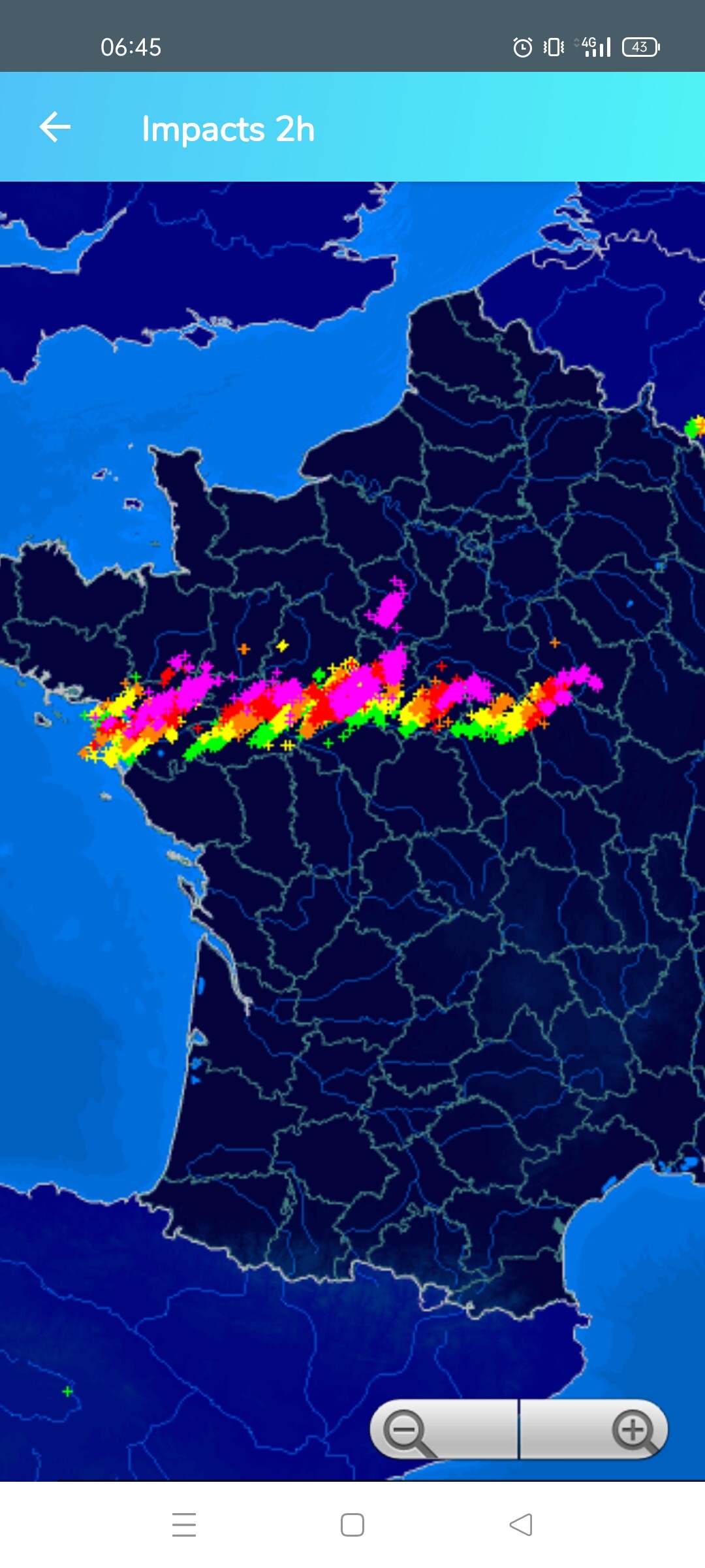
Lots of 20°C+ lows yesterday morning: +21,9°C @ Paris - Lariboisière +21,5°C @ Paris - Porte de Vincennes +21,4°C @ Paris - Saint-Germain +20,3°C @ Paris - Jardin - Luxembourg +20,3°C @ Paris - Montsouris +20,1°C @ Paris - Jussieu - Tour Zamansky +20,3°C @ Le Bourget +21,4°C @ Le Perreux +20,4°C @ Joinville +20,8°C @ Lagny +21,2°C @ Roissy - CDG +20,0°C @ Saint Witz Front approaching from the south this morning. Lots of storms it seems, crossing fingers!  |
|
|
|
Post by rozenn on May 20, 2022 2:19:28 GMT -5
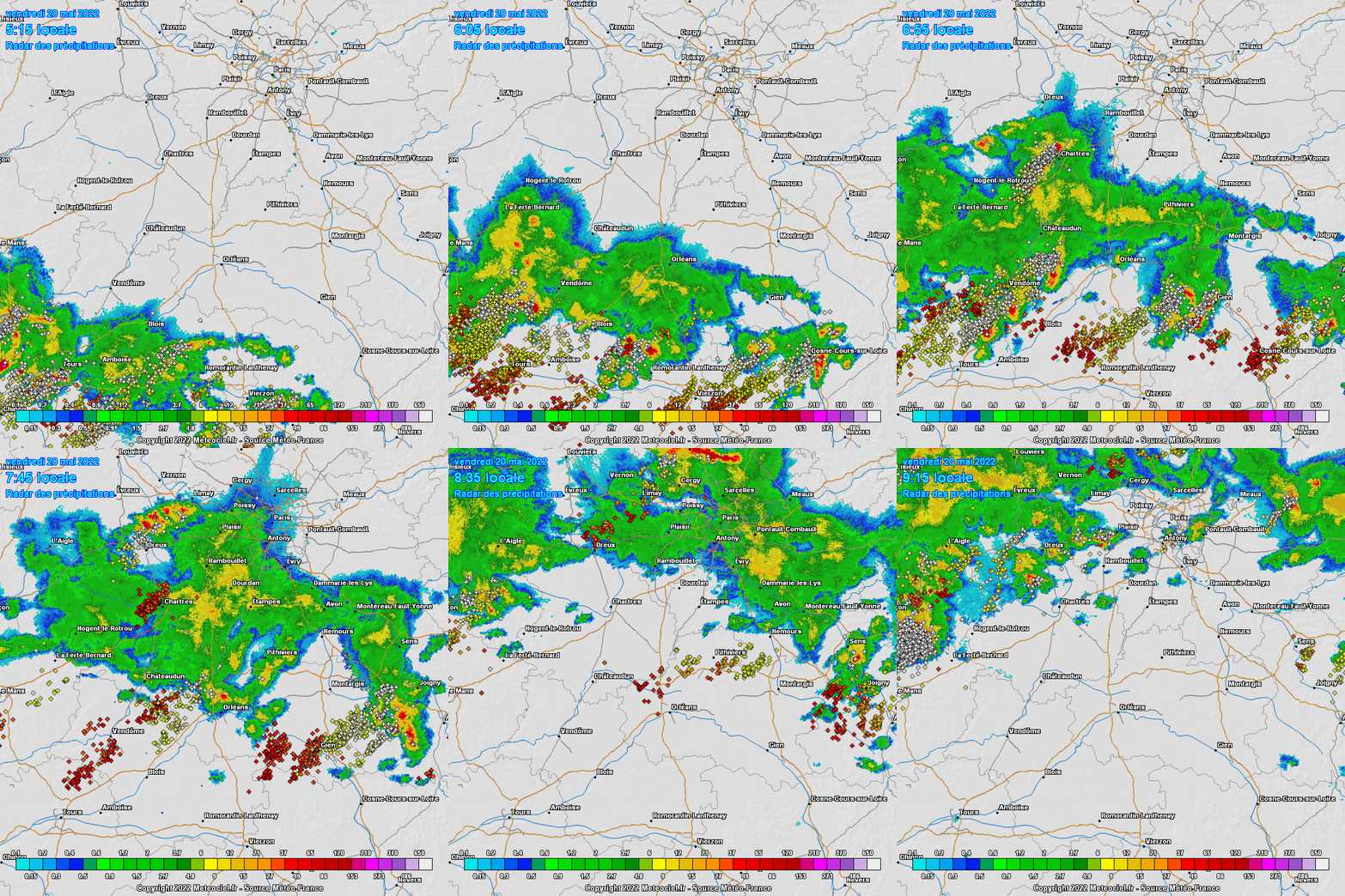
Wow. Just wow. Now that was a bona fide fizzer if there ever was one.  |
|
|
|
Post by Beercules on May 20, 2022 2:44:01 GMT -5
Epic cold front passed through about 7 PM. 6:40 PM: 83 f (28 c) 6:50 PM: 76 f (24 c) 7:00 PM: 59 f (15 c) Now it’s down to 53 (12 c) 40 minutes later. Sometime I really want to be outside while one of these sudden fronts comes, would be cool to feel it suddenly get much colder. NWS now saying 3-4” of snow, Saturday would be the T-5th latest measurable snow. Standard summer day in Melbourne. |
|
|
|
Post by Benfxmth on May 20, 2022 8:08:23 GMT -5
Heat burst last night from a decaying thunderstorm, KPGV's temp spiked to 86°F @ 3:15 AM.   |
|
|
|
Post by rozenn on May 20, 2022 16:04:20 GMT -5
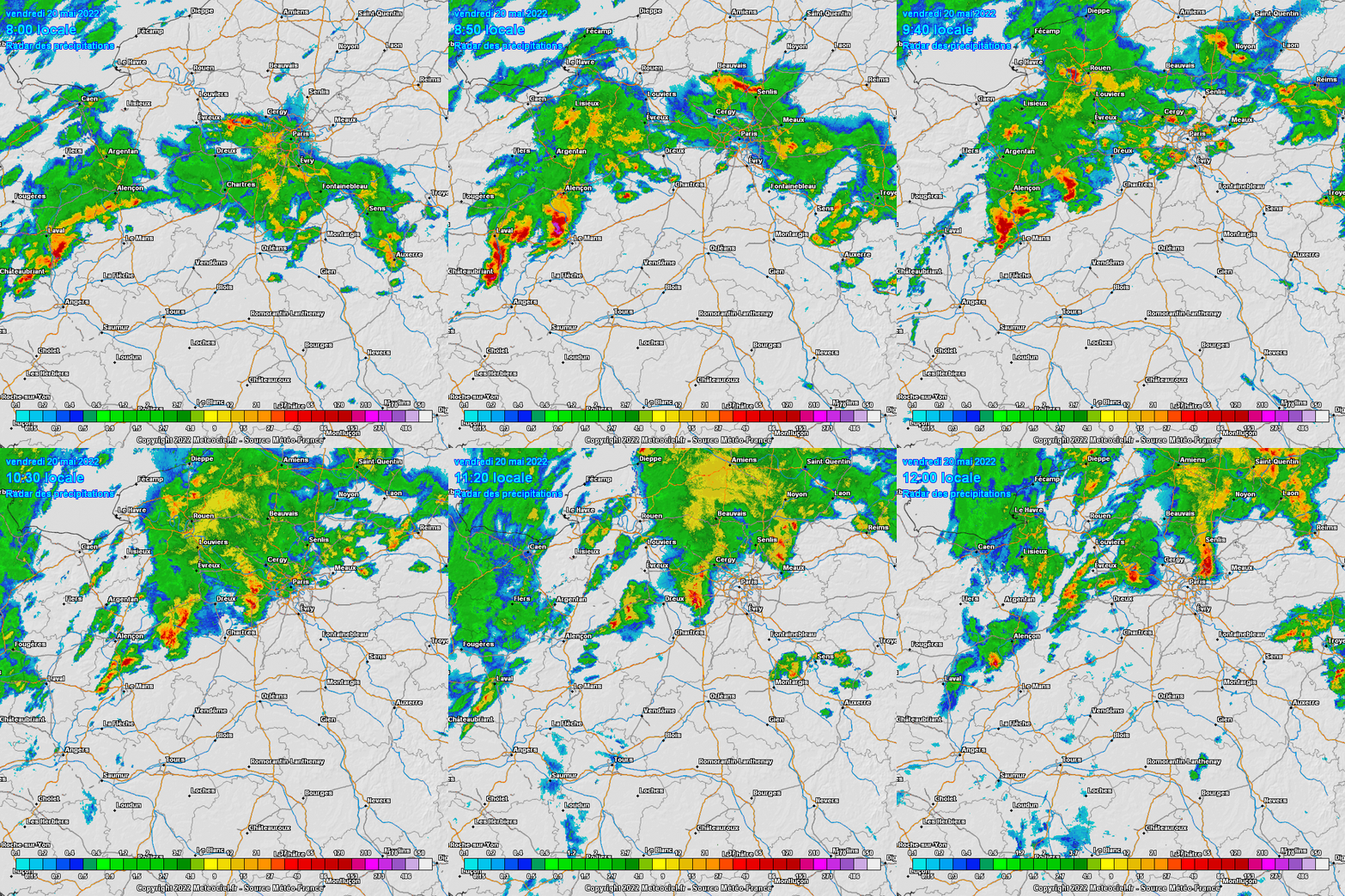
Pic of the hail from one of the two supercells that bypassed Paris later in the morning, from the Le Mans area:  The same general area got storm after storm all morning long. Almost fuck all rain here.   |
|
|
|
Post by greysrigging on May 20, 2022 16:44:42 GMT -5
NZ Slammed By Bitter Winds, Low Level Snow ( source: Weatherzone ) The cold weather system which delivered snow to Tasmania and alpine areas of mainland Australia has migrated across the Tasman Sea and is now unleashing its full fury upon New Zealand. Southern Ocean frontal systems don't often deliver snow to both countries. When they do – as this one has to an extent – the impact tends to be much stronger in either NZ or Australia, and this is very much a New Zealand system which pretty much just paid Australia a brief courtesy visit on the way over. As you can see from the cold speckled air field on Friday morning's satellite image (and we wrote recently about speckled cloud in this story), an airmass with polar origins is now affecting more or less the whole of New Zealand.  Numerous road snow warnings are in effect across the South Island, where snow is falling as low as 500 metres above sea level. That means it's almost down to lake level (approx 300 metres) in Queenstown, the iconic resort town which normally sits well below the snowline even in midwinter. As you'd expect, the South Island ski resorts have seen plenty of late autumn snow from this system.  Image: The Saddle Chair at Treble Cone skifield during a brief sunny break in the May 20 blizzard. In addition to snow and cold temperatures, winds are strong across the entire country with multiple warnings in place. Because of the Covid Pandemic, this will be the first winter since 2019 that Australians are free to visit New Zealand in winter, after borders reopened to tourists on April 13. According to the NZ government, around 160,000 Australians visited the country in the 2019 winter, spending more than $211 million which accounted for around 40 percent of all spending by international tourists. Our business is important to them, and NZ is an equally important alternative southern hemisphere winter destination for Aussie snow lovers, many of whom plan quick trans-Tasman getaways when conditions are better over there. This week's snow isn't yet deep enough to create a meaningful base for the start of the NZ ski season in June, but it's the sort of weather system which will get many Australians thinking about the Kiwi snow for the first time in three seasons. |
|
|
|
Post by Benfxmth on May 20, 2022 18:41:51 GMT -5
Any takers of nearly 7 feet of rain falling in one week? Looks like epic waterfalls
|
|
|
|
Post by nei on May 20, 2022 19:40:54 GMT -5
|
|
|
|
Post by 🖕🏿Mörön🖕🏿 on May 20, 2022 19:44:04 GMT -5
|
|
|
|
Post by Steelernation on May 21, 2022 0:37:12 GMT -5
Well this so called snowstorm was a massive fizzer. Supposedly a trace of snow was recorded but I never saw any, just light drizzle although even that only added to 0.09” (2 mm). Supposed to snow overnight but given how much this afternoon fizzled out and the still warm ground I doubt we get any measurable snow. Meanwhile Denver, CO springs and the Palmer divide are getting pounded. And so is Cheyenne fucking north of here.
Today did only get to 44 (7 c), compared to 86 (30 c) yesterday which is interesting but a low 40s drizzly day is far less fun than a late May snowstorm. Especially when NWS was saying 2-4” would fall we’re getting fucking screwed getting nothing at all.
Well let’s hope for some thunderstorms this week since this event was a fucking failwhale like you’d see in Shitchester.
|
|
|
|
Post by rpvan on May 21, 2022 0:43:57 GMT -5
Had a heavy shower roll through here around 7:30/8pm. At the same time I could see some very dark clouds towards the E/NE (towards Mission -- the town mentioned in the tweet). |
|
|
|
Post by snj90 on May 21, 2022 5:45:43 GMT -5
Extremely thick fog here this morning. 63F.
|
|
|
|
Post by Cheeseman on May 21, 2022 7:26:25 GMT -5
Wow. Just wow. Now that was a bona fide fizzer if there ever was one. -large image snipped- You, my friend, just got Appleton'd. It won't be any solace to you to tell you we got 0.83" (21.1 mm) here between yesterday and the day before. About time ONE of this week's five supposed storm chances pays off. Heat burst last night from a decaying thunderstorm, KPGV's temp spiked to 86°F @ 3:15 AM. -large images snipped- That's epic. I've always wanted to experience a heat burst like that. |
|
|
|
Post by Benfxmth on May 21, 2022 7:32:29 GMT -5
Wow. Just wow. Now that was a bona fide fizzer if there ever was one. -large image snipped- You, my friend, just got Appleton'd. It won't be any solace to you to tell you we got 0.83" (21.1 mm) here between yesterday and the day before. About time ONE of this week's five supposed storm chances pays off.
Or Renmarked. |
|
|
|
Post by ilmc90 on May 21, 2022 7:38:13 GMT -5
64 F/18 C at 8:30AM. Sun is out and the fog is burning off.
Heading up to a toasty 94 F/34 C today. Quite the jump in heat as the highest MTD is 81 F/27 C and YTD is 84 F/29 C.
|
|