|
|
Post by rozenn on May 28, 2018 14:40:48 GMT -5
16.3mm so far from a tstorm in Paris-Montsouris. Pretty weak stuff, but I'll get the rain. Shot of the storm earlier this evening in the countryside just east of Paris: Decent amount of strikes in the last 2 hours. They're few and far between where I am though.   Nice skies over the eastern suburbs:  From "paolo" on Infoclimat |
|
|
|
Post by nei on May 28, 2018 14:58:08 GMT -5
seems like all of northern Europe is getting good storms
|
|
|
|
Post by rozenn on May 28, 2018 15:50:51 GMT -5
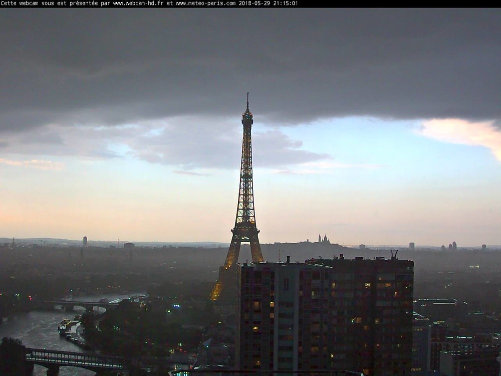
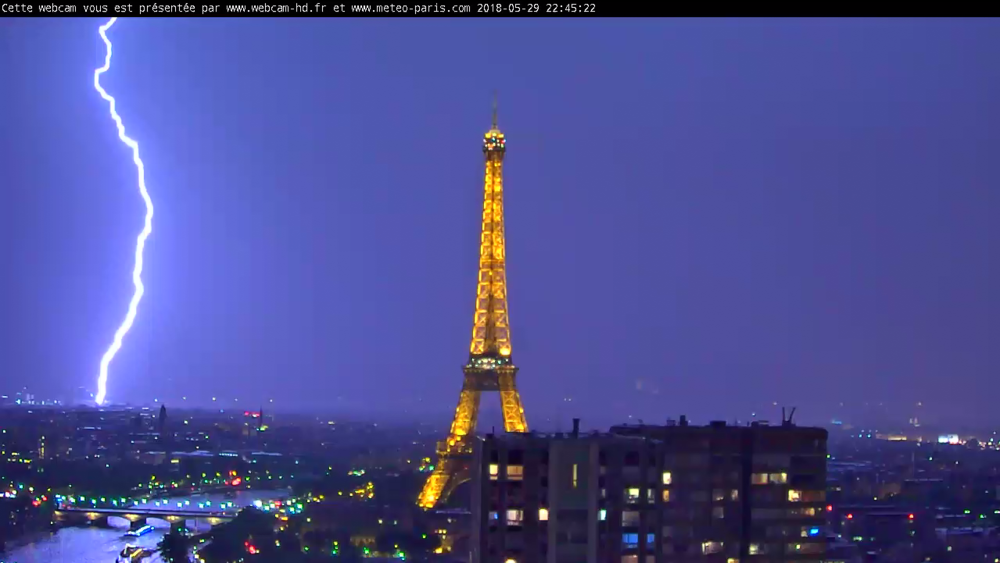
Nothing notable at my exact position, but a lot of the metro has had nice storms. Cells are constantly forming behind the MCS that passed through earlier this evening. Strange stuff, usually MCSs eat all the energy, though this one was pretty weak.
Eiffel tower struck by lightning a couple hours ago:
|
|
|
|
Post by 🖕🏿Mörön🖕🏿 on May 29, 2018 9:33:42 GMT -5
fuck, even London gets more thunderstorms than here.
|
|
|
|
Post by Donar on May 29, 2018 15:47:05 GMT -5
Epic thunderstorm this afternoon, couldn't leave the uni building for half an hour because it was raining too hard. A friend sent me this picture: ![]()  |
|
|
|
Post by rozenn on May 29, 2018 17:09:55 GMT -5
^^ Holy fuck that looks serious.  Reminds me of the storms the Med gets in fall. Another evening, another storm here, with rainfall rates up to 250 mm/h. Looks like my spot got the most rain out of it, a hefty 55 mm according to the radar.    At the beginning:  Loads of CG lightning  Aftermath. I was outside eating on a terrace, needless to say I won't wear the same pants tomorrow. On the way home, the subway didn't stop at a tation because it was "flooded". Lots of wandering for these poor folks (Berlin-Paris flight).   |
|
|
|
Post by knot on May 29, 2018 17:10:46 GMT -5
Freezing drizzle, with potential sleet as of now (1,228 m AMSL; 33° 51' 38.67" S). First precipitation in a long while! About 12.2 mm recorded at Lithgow (Marrangaroo Defence) as of this morning; all fell in one night, and is still falling now  |
|
|
|
Post by Donar on May 29, 2018 17:24:52 GMT -5
A video from another town, it was raining like that here too. Sadly our weather station is to the north of Marburg where the storm didn't hit that hard... would have been impressive rainfall totals.
|
|
|
|
Post by rozenn on May 30, 2018 16:27:03 GMT -5
The storm finally chose to focus on the eastern suburbs. Too bad. At least 1 lightning/second, though most of it is cloud to cloud. Got enough rain to have to move in to but not enough for it to be interesting. Bummer. I'm devastated.
|
|
Deleted
Deleted Member
Posts: 0
|
Post by Deleted on Jun 1, 2018 11:57:59 GMT -5
Getting a slice of the action, albeit a humble slice. Ireland is being peppered.   |
|
|
|
Post by ral31 on Jun 3, 2018 16:14:56 GMT -5
Thunderstorm formed nearby this afternoon, but moved away... Areas to my south have been getting quite a bit of lightning and heavy rain.
|
|
|
|
Post by Steelernation on Jun 3, 2018 17:02:04 GMT -5
It’s rained all day but no thunder, 0.60” (15 mm) at the airport so far, 0.88” (22 mm) at the nearest PWS.
Not sure when the last time we haven’t had a single thunderstorm by June...
Today’s rainfall snaps the dry streak at 11 days. That was the longest dry streak since last September.
|
|
|
|
Post by rozenn on Jun 6, 2018 16:56:11 GMT -5
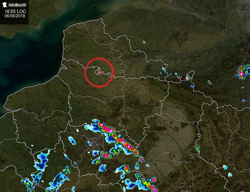
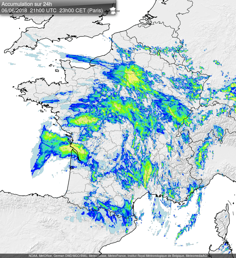
Up to 100 mm the night before last in the SW outskirts of Paris, , leading to local flooding:   Same stuff last night, but on the eastern side, and again a few hours ago with a nice line:  Last night there were no less than 3 MCS systems over the northern half of France. I definitely prefer this to Nice's rainless summers.  Large are with 50 mm+ totals again over the last 24 hours:  Blitzortung's 24-hour map shows lots of different colors over my region. Indeed storms occured at night, in the morning and again in the late afternoon. Large areas of the continent saw storm activity today.  |
|
|
|
Post by 🖕🏿Mörön🖕🏿 on Jun 6, 2018 18:10:23 GMT -5
A video from another town, it was raining like that here too. Sadly our weather station is to the north of Marburg where the storm didn't hit that hard... would have been impressive rainfall totals. Wow. Germany gets surprisingly good storms. Saw a good one when I was around Köln in July 2007 but nothing like that. |
|
|
|
Post by Morningrise on Jun 9, 2018 23:40:28 GMT -5
Huge line of thunderstorms making their way across Western Saskatchewan right now...   |
|
|
|
Post by ral31 on Jun 10, 2018 10:02:16 GMT -5
Looks like at t-storm could be headed this way already! I've been hearing thunder.  |
|
|
|
Post by rozenn on Jun 10, 2018 11:44:16 GMT -5
There's a rather active cell 20km from here approaching and I can't see shit. That's how hazy it's been lately.  Lightning map for the last 24 hrs  ![]() |
|
|
|
Post by rozenn on Jun 10, 2018 13:24:26 GMT -5
Loads of rain and sizeable hailstones from that storm all over the southern suburbs: Large zone of 350+ mm/h rainfall rates (white):  |
|
|
|
Post by ral31 on Jun 10, 2018 14:21:18 GMT -5
The convection late this morning was disappointing. Got some brief heavy rain I think less than a tenth of an inch. A couple of lightning strikes, one somewhat close. We might not get enough warmth over the remainder of the afternoon to build up any additional storms. It's remaining fairly overcast...
|
|
|
|
Post by urania93 on Jun 10, 2018 14:40:17 GMT -5
I'm re-posting the rain shower video I made in Turin the last Thursday before introducing something more interesting (and also dangerous and worrisome) ^ it has been raining like this at least a couple of times per week for about one month and an half at the moment, this is Turin in the evening of the last Thursday In the meanwhile other more intense rain showers caused really serious floods of various magnitude all over the region, of which the worse one seems to have happened in this municipality, in the neighbours climbing on the mountain side just north of the center. A little water stream suddenly flooded, causing a lot of troubles because of the large amounts of water and mud it brought down from the mountain and because it passed though a neighbour with a lot of houses: ^ during the flood ^ video made with a drone just after the flash-flood. About 200 people had to leave their homes, and as you can see from the second video there are quite significant damages. May in here is always a rainy month and floods are nearly the norm, in particular along water streams like that one, but that stream seems to be an exception. In the last month and an half it over-flooded for 3 times (or it is 4 already? I'm not completely sure on this), but the amount of rain we are getting is not enough for justifying this. The problem was actually attributed to the large fires which burned down all the mountain side just above that little town (and several neighbour municipalities) during the last October, completely destroying the undergrowth and thus reducing the the soil capacity to restrain the rain water and thus making flash-floods much more likely. That's really worrisome in my opinion, in particular looking at the weather forecast for the next few days (tomorrow's forecast in particular doesn't look well at all). |
|